SuperMaps
The SuperMaps provide a visual representation of events in your enterprise.
SuperMaps must first be configured in Argent XT and Argent AT, where you can specify the background image, the location of the dots, colors, and hotlinks. All these are faithfully reproduced in Argent Commander, but with a stunning Web 2.0 interface.

Hovering your mouse over a dot provides a quick summary of what the dot represents, and how many unanswered, answered and resolved events there are at that location.
Clicking on a dot launches a popup version of the Argent Commander Console, where the events pertaining to that location are automatically filtered for you.
You can answer/edit events here just like the Argent Commander Console.
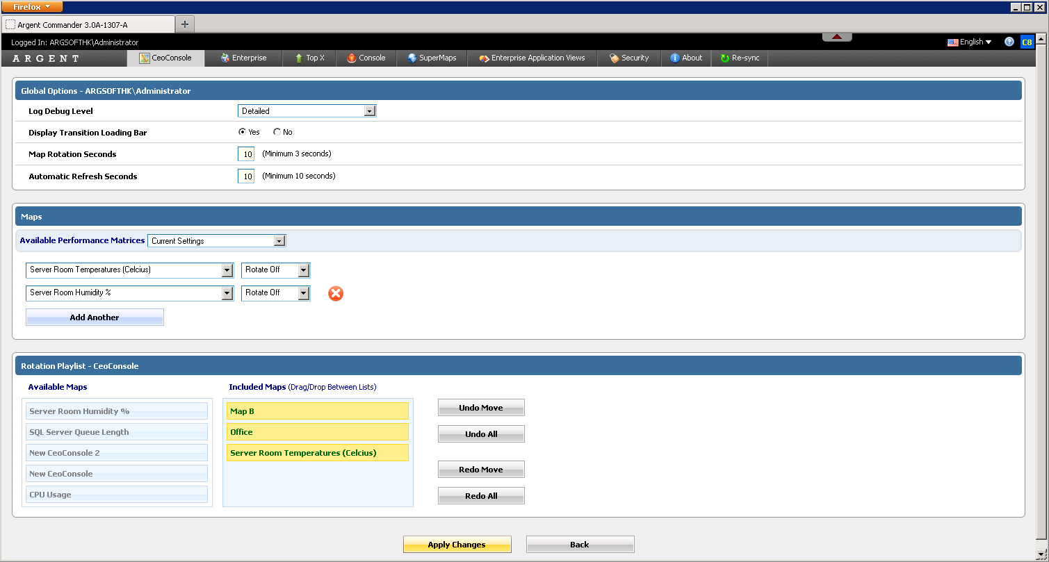
Rotation Playlists
Maps can be configured to rotate every X seconds, allowing continuous updates without having to move a muscle.
“Rotation Playlists” allow customers to specify the order and inclusion of maps to rotate, and are accessed through “Configure This Screen”
By default, ALL granted maps are included in the rotation
Note: As part of the design, Argent considered the possibility that a customers views a map that is NOT part of the playlist, and proceeds to start the rotation from this map
In this case, the map will be temporarily added into the rotation as long as the customer stays on the page
Map Dot Diameter
The dot images have base dimensions of 24 x 24 pixels
When maps are overly large, they are scaled down so they fit nicely on the screen
If the maps are scaled, the dots and labels all need to be scaled in the same manner to ensure the positioning of the dots are correct
The dots were previously scaled down to a minimum of 16 x 16 pixels
For some customers, 16 x 16 pixels is too small
The “Configure This Screen” button has a configurable option called “Map Dot Diameter”, which allows a fixed-width, or “Automatically scaled”
Maximum Width and Height Settings
For customers with very large screens, customers may want to configure the map to scale at a much larger width or height
Other customers may want to keep their maps smaller so they can show multiple maps on the same page, preserving screen real-estate
This setting is controlled in the ARGSOFT_INTERNAL_SETTINGS.XML file, under the XML entries LARGE_MAP_HEIGHT_LIMIT, LARGE_MAP_WIDTH_LIMIT, SMALL_MAP_HEIGHT_LIMIT, and SMALL_MAP_HEIGHT_LIMIT (for half-sized maps)
The values are in pixels, and the setting applies to all users — if the values are blank, the Argent Commander defaults are used
The calculation for scaling works like this:
1. If the map’s width (in pixels) is greater than the ‘Maximum Width’, the map’s width is scaled down to the ‘Maximum Width’ to obtain the Scale Factor
2. The ‘Scale Factor’ is also applied to the height, to ensure the width and height ratios remain the same (otherwise the image becomes distorted)
3. If the resultant height is also greater than the ‘Maximum Height’, the map’s height is scaled down to the ‘Maximum Height’, and a second Scale Factor is obtained, and applied onto the width
4. At this point, both the width and height will be less than the Maximum Width and Maximum Height
5. The Scale Factor is subsequently re-used for the calculation of dots and label-positioning