CeoConsole Page
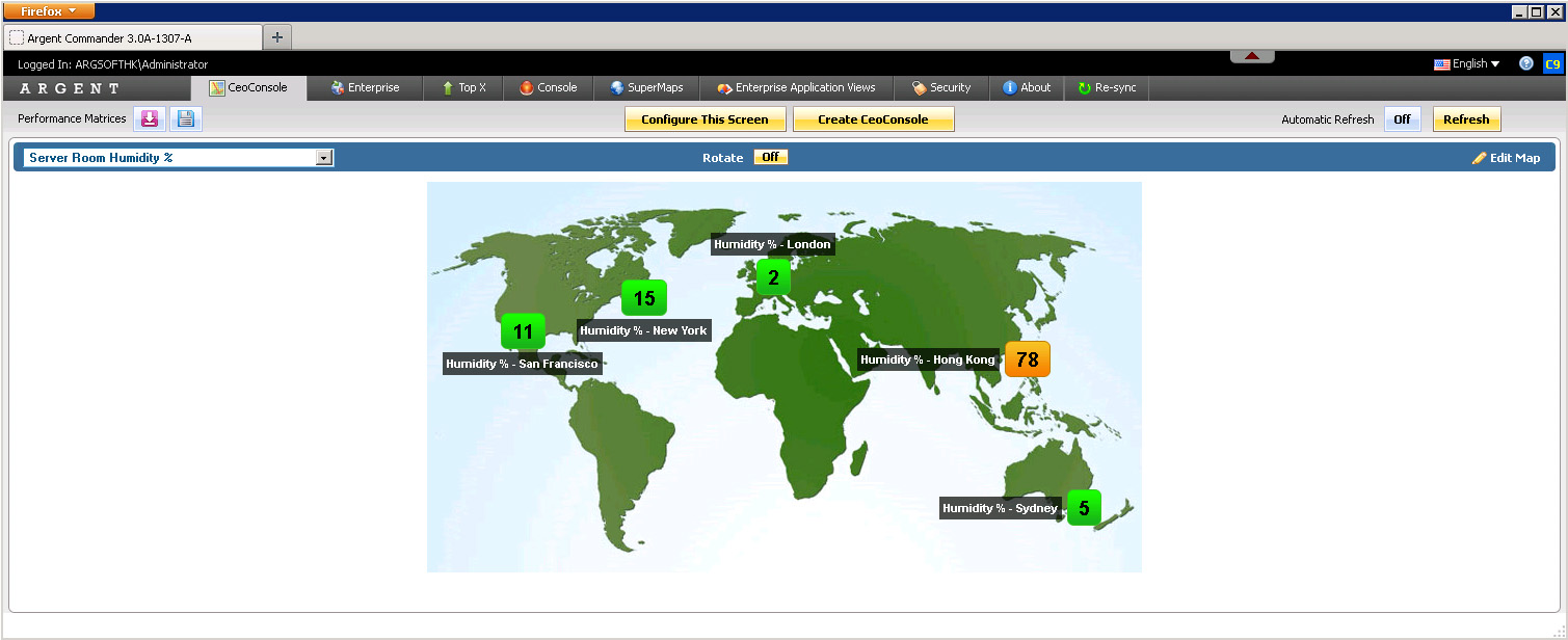
With Argent’s unique CeoConsole you see — for the first time ever — all key metrics of all your locations worldwide
As the newest component of Argent’s acclaimed Argent Commander product line, the CeoConsole gives harried administrators and senior executives a single pane of glass for all your automation and monitoring needs
And Argent’s Systems Integration division can supply and install any temperature and humidity sensors in your data centers anywhere in the world (click here to learn why humidity is a secret killer of servers — http://help.Argent.com/#kbi_310316)
Argent’s new CeoConsole — a single pane of glass of all critical facilities worldwide
Technical Details
The CeoConsole allows customers to plot Argent Predictor data onto a map, and set specific range thresholds for color changes
Each “dot” points to a specific server, product, object, counter and instance stored in Argent Predictor
Here are some of the key features:
- Drag-and-drop interface — drag a dot to any location on the map.
- Click on any empty area of the map to add a new dot.
- Cross-product — combine disparate metrics from any Argent product.
- Specific range thresholds to denote different colors.
- Hovering your mouse over a dot will show a customizable graph, e.g. the past 24 hours of CPU usage.
- The standard Argent Commander Security views and privileges to determine what specific users or groups can do or see.
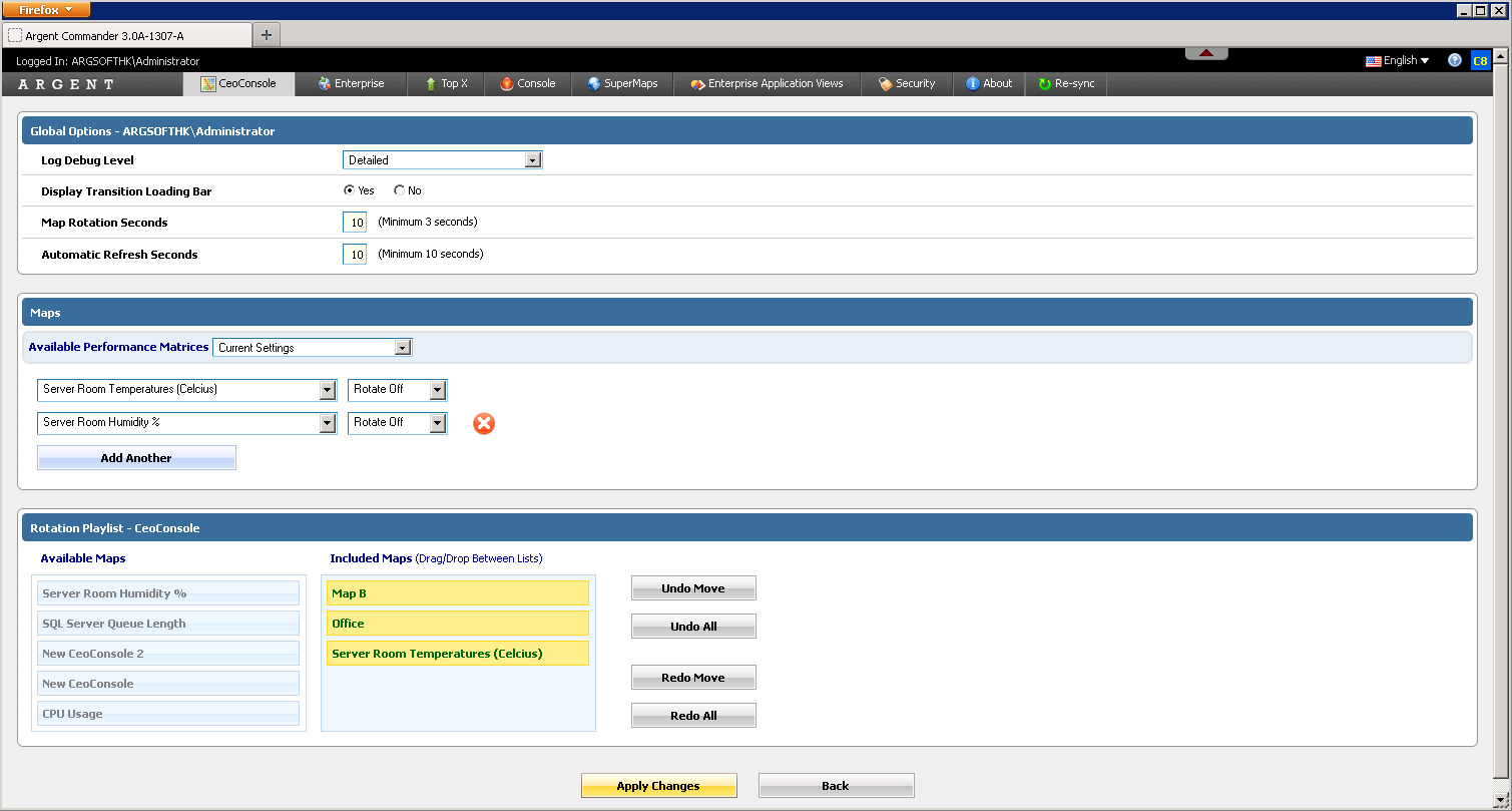
Rotation Playlists
Maps can be configured to rotate every X seconds, allowing continuous updates without having to move a muscle.
“Rotation Playlists” allow customers to specify the order and inclusion of maps to rotate, and are accessed through “Configure This Screen”
By default, ALL granted maps are included in the rotation
Note: As part of the design, Argent considered the possibility that a customers views a map that is NOT part of the playlist, and proceeds to start the rotation from this map
In this case, the map will be temporarily added into the rotation as long as the customer stays on the page
Maximum Width and Height Settings
For customers with very large screens, customers may want to configure the map to scale at a much larger width or height
Other customers may want to keep their maps smaller so they can show multiple maps on the same page, preserving screen real-estate
This setting is controlled in the ARGSOFT_INTERNAL_SETTINGS.XML file, under the XML entries LARGE_MAP_HEIGHT_LIMIT, LARGE_MAP_WIDTH_LIMIT, SMALL_MAP_HEIGHT_LIMIT, and SMALL_MAP_HEIGHT_LIMIT (for half-sized maps)
The values are in pixels, and the setting applies to all users — if the values are blank, the Argent Commander defaults are used
The calculation for scaling works like this:
1. If the map’s width (in pixels) is greater than the ‘Maximum Width’, the map’s width is scaled down to the ‘Maximum Width’ to obtain the Scale Factor
2. The ‘Scale Factor’ is also applied to the height, to ensure the width and height ratios remain the same (otherwise the image becomes distorted)
3. If the resultant height is also greater than the ‘Maximum Height’, the map’s height is scaled down to the ‘Maximum Height’, and a second Scale Factor is obtained, and applied onto the width
4. At this point, both the width and height will be less than the Maximum Width and Maximum Height
5. The Scale Factor is subsequently re-used for the calculation of dots and label-positioning